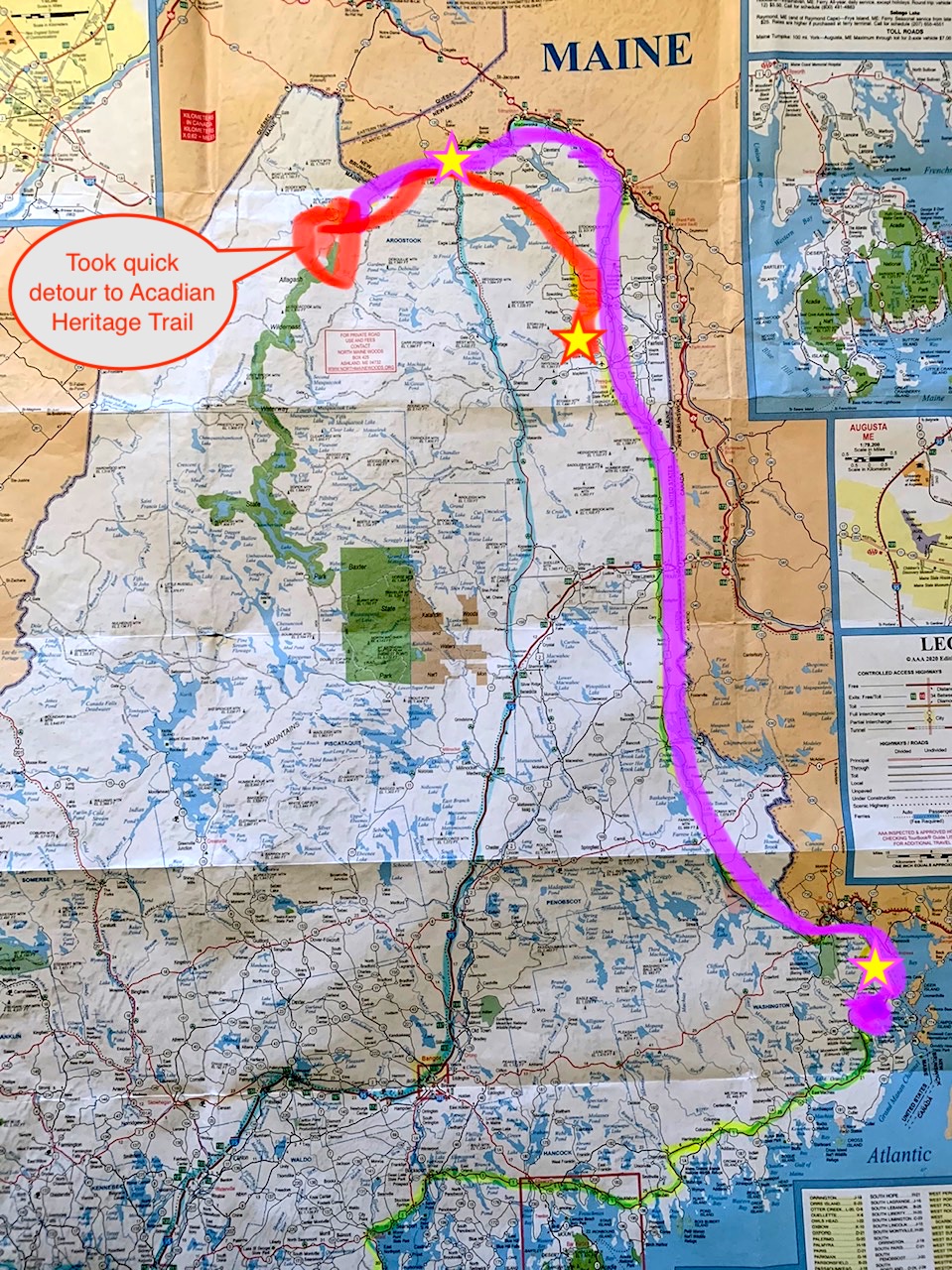
On the advice of the friendly motelier at the Aroostook Hospitality Inn in Washburn (not the one in Van Buren), I took what I thought would be a quick detour to the beginning of the Acadian Heritage trail in Dickey. Steve told me I’d be going to the last bit of paved road in the United States before Canada and would get to follow a well-marked, informative self-guided tour of the Acadian experience in Northern Maine. It added a little over an hour in the wrong direction from Fort Kent, but I was up at 6:30 a.m. anyway, so why not?
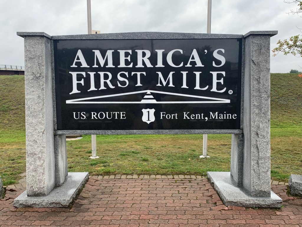
I can’t say I’m glad I did it, but I’ll never see the beautiful, rugged banks of the St. John River again in my life. The road was paved all the way (maybe I didn’t go far enough) and the historical society with all the deets was closed. By the time I got to Mile Zero, it was a little after 9:00 and just beginning to rain.
And BOY, did it rain! Turns out all the trucks with heavy timber loads that barrel down Route 1 leave subtle ruts in the road like the wagon trails going to and from Walnut Grove. Ruts you don’t notice until they fill up with water and suddenly that little yellow car with the squiggly lines lights up on the dash as if you don’t already know you’re hydroplaning. Once I figured out what was happening I just slipped into the space between the rails, so to speak. No harm, no foul.
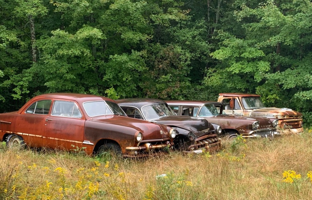
Because of the weather, I did not get the chance to take all the pictures I otherwise would have: the remarkable number of abandoned houses, with caved-in roofs or walls folding in on themselves; shacks whose porches are stacked with bags and bags of recyclables; the random outsider art installations, otherwise known as sheds festooned with deliberate crap.
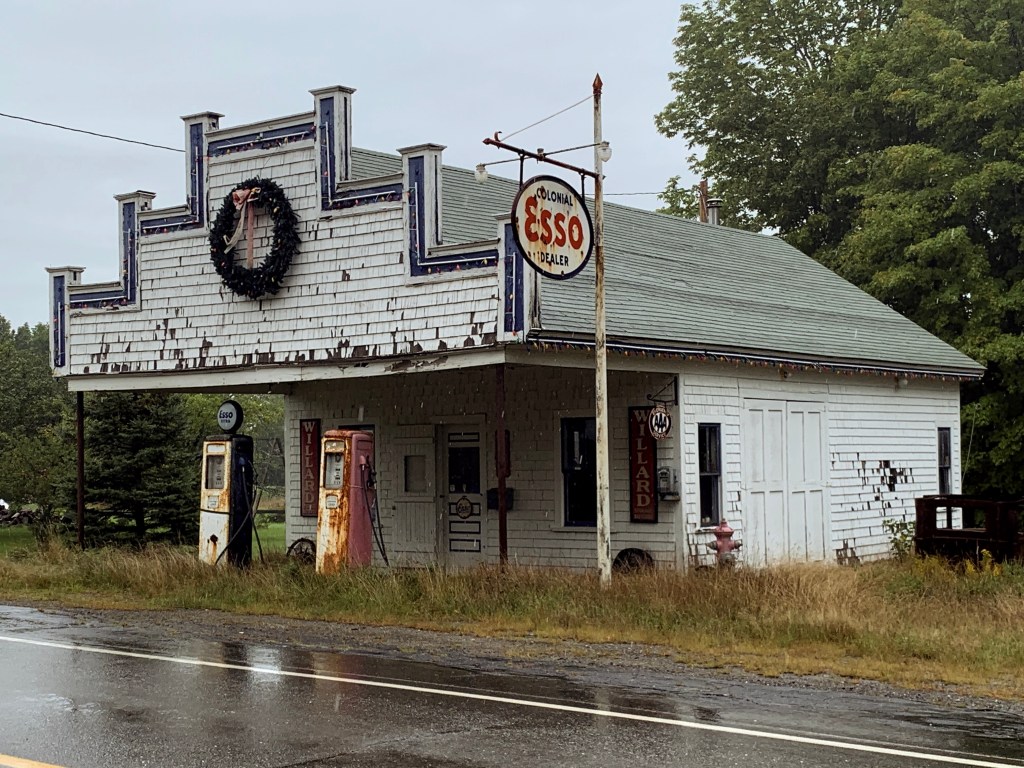
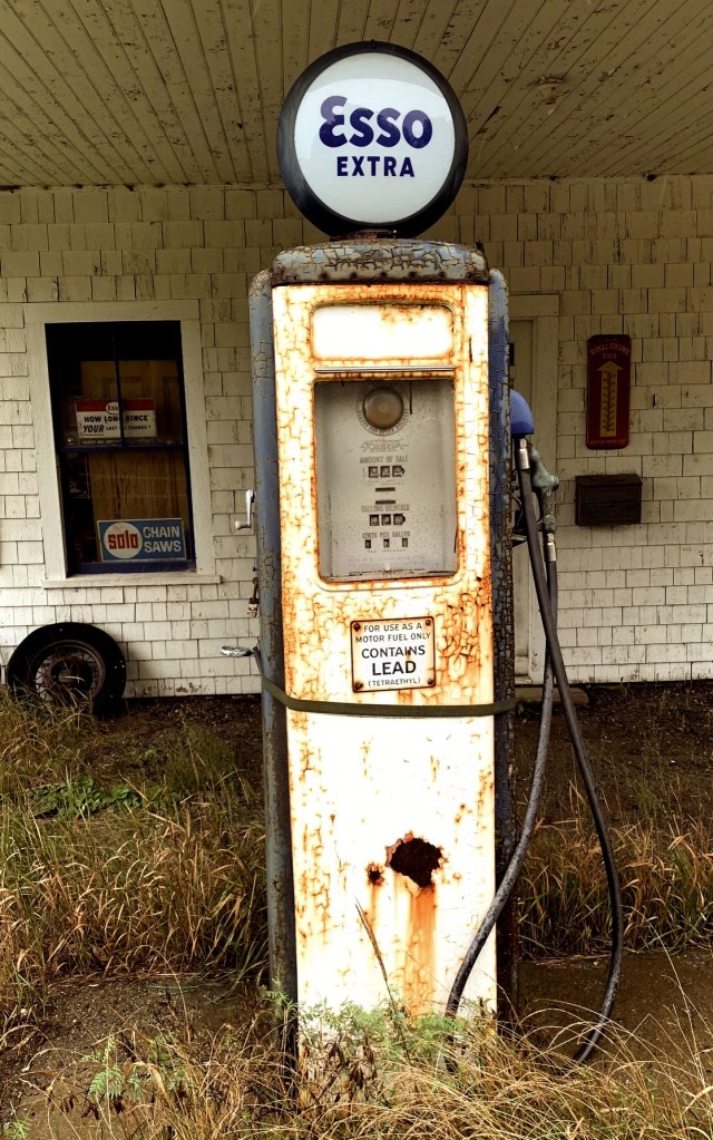
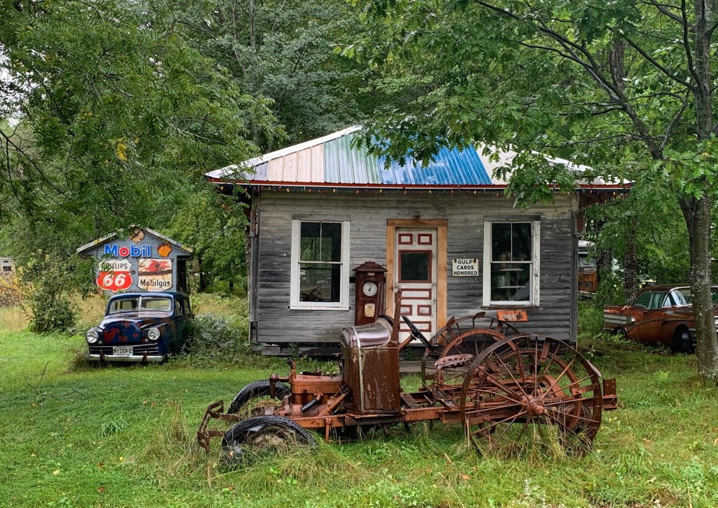
Somewhere between Houlton and Calais (pronounced “Callous”) I caught a break in the weather and passed an old Esso station flanked by rusted cars. Across the street were the remains of a rival Gulf station, also surrounded by rusted cars. Or maybe somebody it’s another art installation…

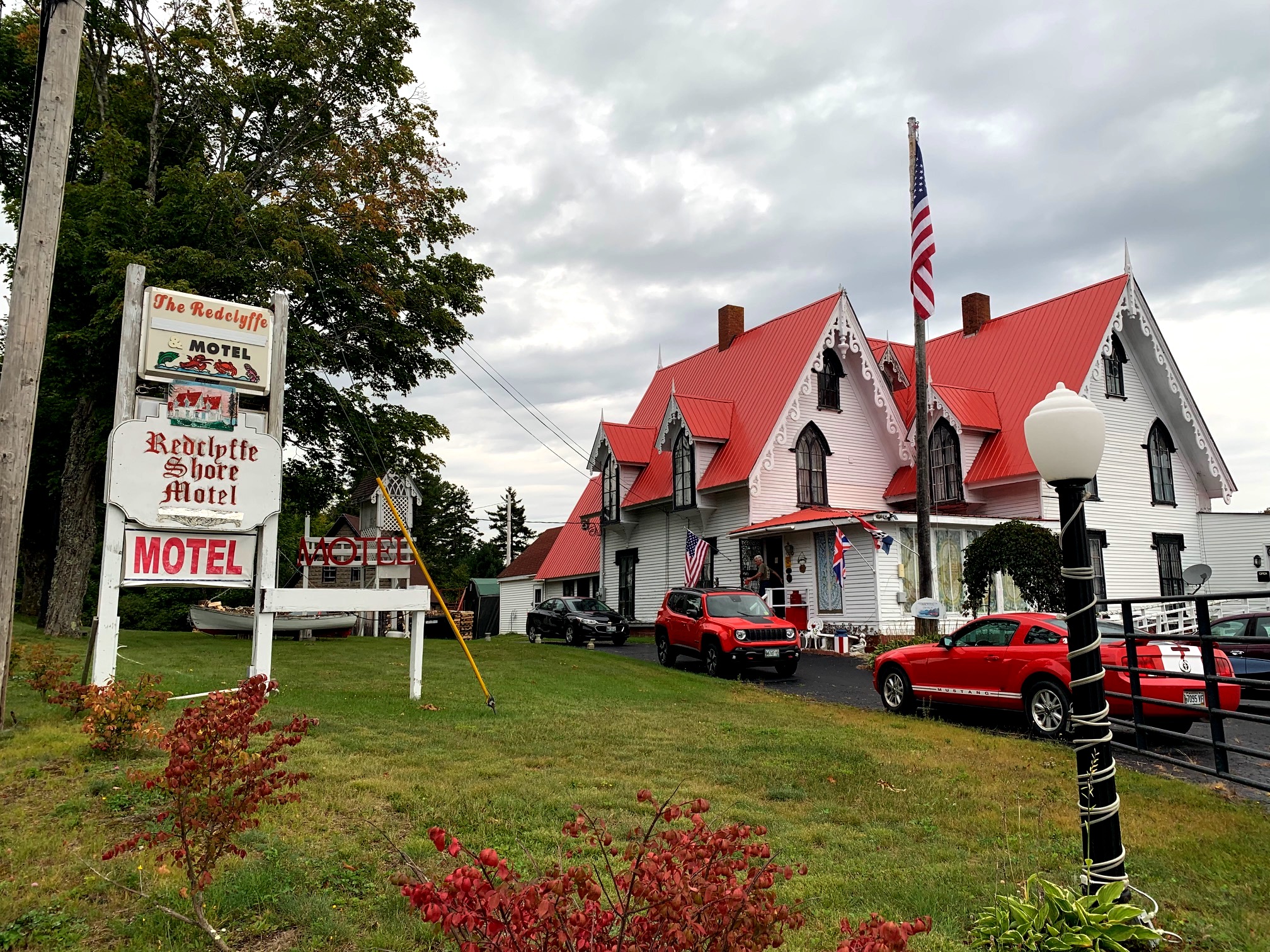
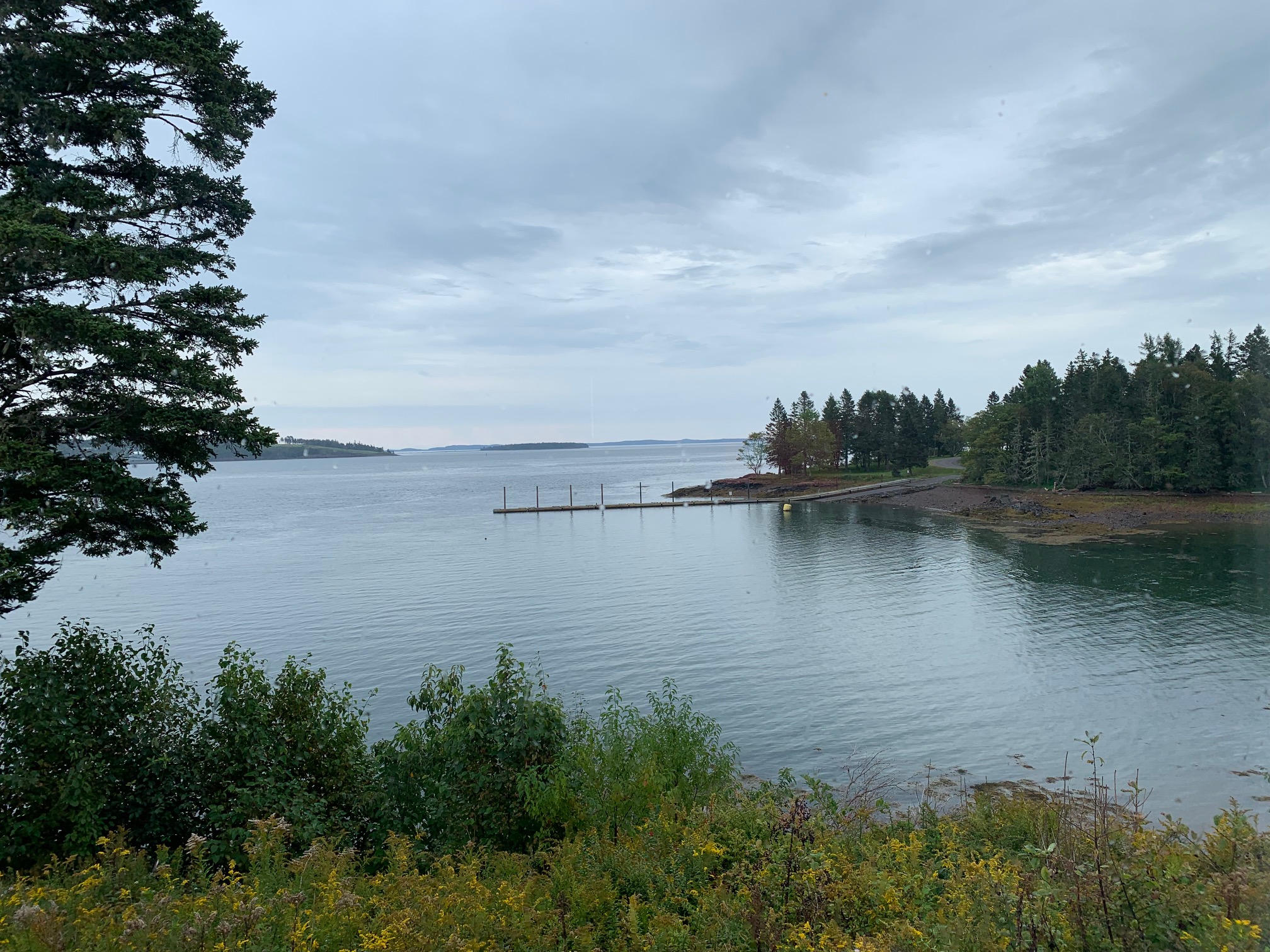
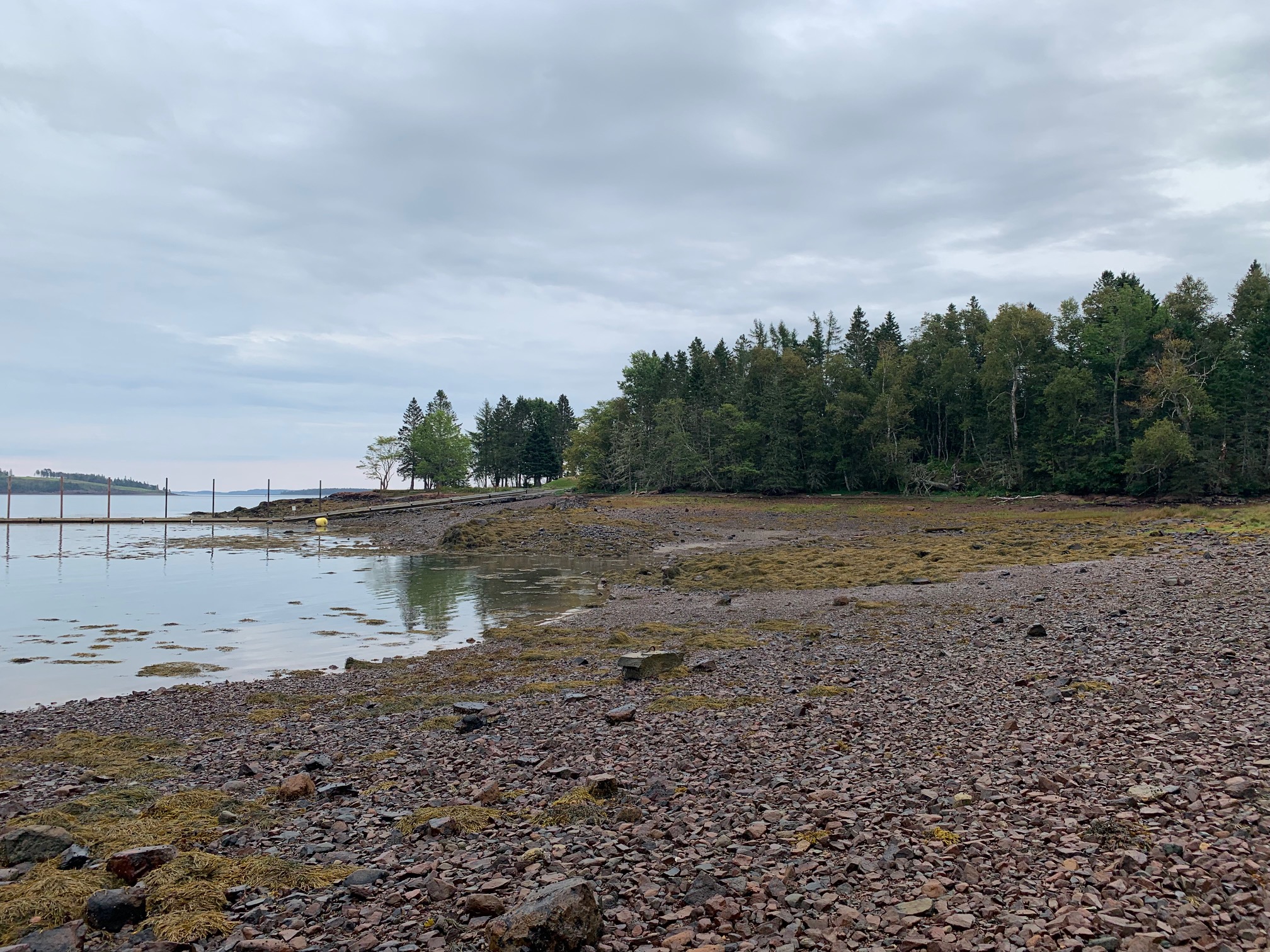
The proprietress of the motel I’m in tonight explained why the time keeps flipping ahead an hour, then back again. It is also the reason, she apologized, that there aren’t that many TV channels: CANADA. I noticed this up near the mystery trail — also a stone’s throw across a different river to Canada. I’d pass over a bridge and my car would say it was 8:55, while my fitbit said it was 7:55. Then my car would correct itself and my fitbit would be off by an hour. Same here in Robbinston. My room overlooks a rocky, snaily beach that is also a boat launch on the St. Croix River. Just past Navy Island is Passamaquoddy Bay.


Meanwhile, I will be flipping my map to the lower bit of Maine in preparation for tomorrow. Speaking of maps…
Rand McNally Thurber Carnival